
Mapping California's Politically Vulnerable Communities
Static election maps - 2 LAYER
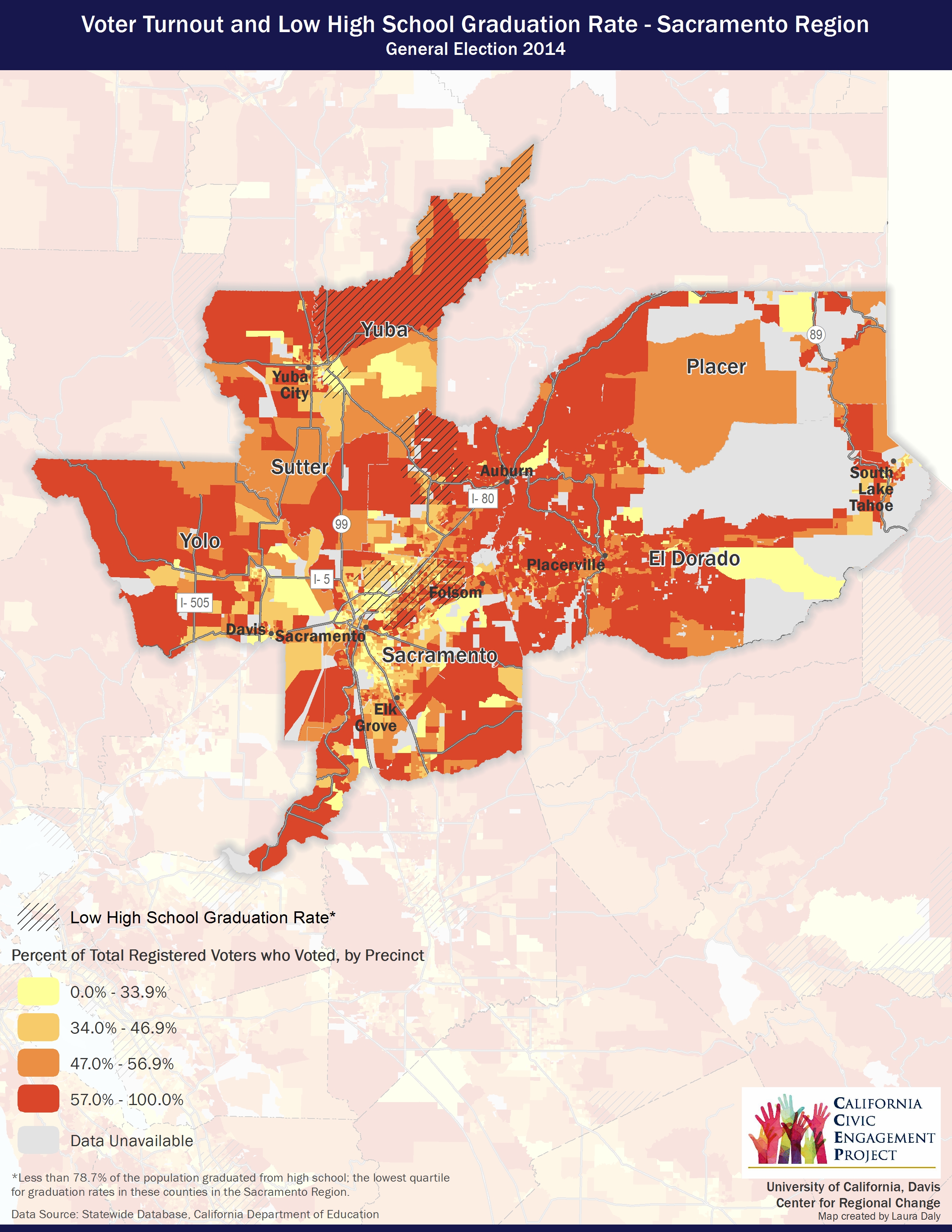
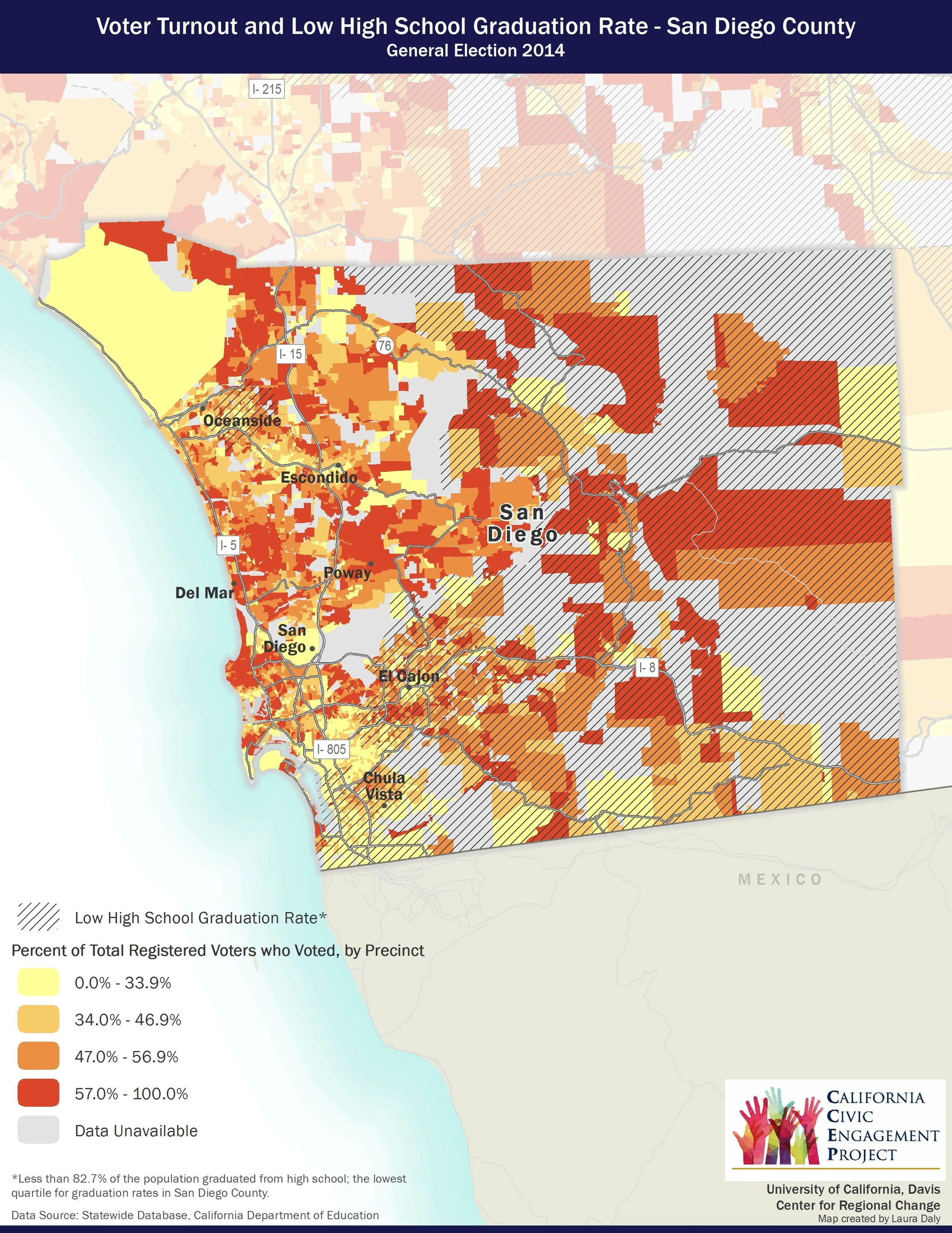
These static maps show registered voter turnout overlaid with individual economic, educational and health outcome data. Factors examined include education (low high-school graduation rates, a lack of post-secondary education), economic factors (poverty, high unemployment rate, not having access to a vehicle), health (poor environmental health, high teen birth rates, premature mortality) and civic access (limited English proficiency, percent of eligible voters).
Detailed static maps cover five key regions: the San Francisco Bay Area, Sacramento, San Joaquin Valley and the greater Los Angeles, and San Diego areas. For more information on the methodology used in this mapping research, click here.
See the Mapping California's Politically Vulnerable Communities project page for interactive 2012 and 2014 general election maps.